Category:Stoke Rochford
Jump to navigation
Jump to search
village in Lincolnshire, England, UK  | |||||
| Upload media | |||||
| Instance of | |||||
|---|---|---|---|---|---|
| Location | South Kesteven, Lincolnshire, East Midlands, England | ||||
 | |||||
English: Stoke Rochford is a small village near Grantham in Lincolnshire. It is most notable for its beautiful Stoke Rochford Hall, designed by William Burn and built in 1815, which was gutted by fire on January 25, 2005. This is the NUT's national training centre, and a popular and picturesque venue for conferences and wedding receptions. Until the late 1970s, it was known as Kesteven College of Education, a teacher training college.
Suomi: Stoke Rochford on pieni kylä, joka sijaitsee Lincolnshiren shire-kreivikunnassa, lähellä Granthamia. Kaupungin suurimpiin nähtävyyksiin kuuluu William Burnin suunnittelema Stoke Rochford Hall, joka rakennettiin vuonna 1815. Rakennus kärsi palosta vuonna 2005. Kuuluisia Stoke Rochfordissa nykyään asuvia ovat voimailija Geoff Capes sekä Walesin prinsessa Dianan nuorin sisko Sarah McCorquodale.
Subcategories
This category has the following 3 subcategories, out of 3 total.
M
S
W
Media in category "Stoke Rochford"
The following 134 files are in this category, out of 134 total.
-
 87 metre spot height, Grantham Road - geograph.org.uk - 3795032.jpg 1,024 × 768; 191 KB
-
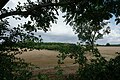
 A glimpse beyond - geograph.org.uk - 5096549.jpg 6,000 × 4,000; 6.89 MB
-
 A peek over the hedge - geograph.org.uk - 5096545.jpg 6,000 × 4,000; 7.26 MB
-
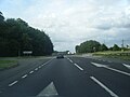
 A1 Great North Road near Stoke Rochford - geograph.org.uk - 4222431.jpg 640 × 480; 255 KB
-
 A1 layby - geograph.org.uk - 2644128.jpg 640 × 428; 85 KB
-
 A1 northbound at Stoke Rochford turn - geograph.org.uk - 5132751.jpg 640 × 480; 41 KB
-
 A1 southbound Farm Traffic - geograph.org.uk - 3502103.jpg 2,256 × 1,504; 2.04 MB
-
 An Autumn walk - geograph.org.uk - 5189174.jpg 1,024 × 768; 218 KB
-
 Approaching High Dyke - geograph.org.uk - 3999689.jpg 1,437 × 1,144; 452 KB
-
 Autumn colours from Easton Lane - geograph.org.uk - 282068.jpg 640 × 480; 103 KB
-
-
 B6403, High Dike - geograph.org.uk - 4214526.jpg 640 × 480; 322 KB
-
 B6403, High Dike - geograph.org.uk - 4214531.jpg 640 × 480; 331 KB
-
 Bridge 231 on High Dike road - geograph.org.uk - 4019747.jpg 3,088 × 2,056; 3.67 MB
-
 Bridge over the Cringle Brook - geograph.org.uk - 4945441.jpg 1,024 × 768; 294 KB
-
 Bridleway by a plantation of poplars - geograph.org.uk - 6302584.jpg 1,024 × 756; 356 KB
-
 Bridleway to Stoke Rochford - geograph.org.uk - 6303566.jpg 1,024 × 768; 200 KB
-
 Bridleway track through Stoke Rochford Park - geograph.org.uk - 5517912.jpg 3,776 × 2,520; 3.54 MB
-
 Bus shelter, Grantham Road - geograph.org.uk - 3795037.jpg 1,024 × 768; 210 KB
-
 Canner's Lane (bridleway) - geograph.org.uk - 3076829.jpg 640 × 480; 69 KB
-
 Canner's Lane (track) - geograph.org.uk - 4017792.jpg 4,272 × 2,848; 7.41 MB
-
 Canner's Lane (track) - geograph.org.uk - 4025435.jpg 4,272 × 2,848; 5.55 MB
-
 Canner's Lane - geograph.org.uk - 6302715.jpg 1,024 × 768; 256 KB
-
 Canner's Lane near Easton Lodge - geograph.org.uk - 4566464.jpg 4,320 × 3,240; 5.41 MB
-
 Cattle grid and South Lodge, Stoke Rochford (geograph 6634563).jpg 1,024 × 768; 316 KB
-

-
 Cottage, School Close, Stoke Rochford (geograph 6635056).jpg 1,024 × 768; 271 KB
-
 Cringle Road, Stoke Rochford - geograph.org.uk - 69368.jpg 480 × 640; 174 KB
-
 Crop field off Canner's Lane - geograph.org.uk - 3076830.jpg 640 × 480; 76 KB
-
 Dead gnarled tree - geograph.org.uk - 6247782.jpg 683 × 1,024; 226 KB
-
 Deepest Lincolnshire - geograph.org.uk - 4001677.jpg 1,145 × 1,589; 412 KB
-
 Easton Lane eastwards - geograph.org.uk - 2627740.jpg 640 × 499; 141 KB
-
 Easton Lane westwards - geograph.org.uk - 2627739.jpg 640 × 487; 112 KB
-

-

-
 Farm buildings, Heslin's Barn Farm - geograph.org.uk - 6302711.jpg 1,024 × 768; 209 KB
-
 Farm Ford on the River Witham near Grange Farm - geograph.org.uk - 2025067.jpg 3,872 × 2,592; 2.4 MB
-

-
 Farm track near Cindertrack Plantation - geograph.org.uk - 6303574.jpg 1,024 × 768; 227 KB
-
 Farm track off Pit Lane - geograph.org.uk - 6322141.jpg 1,024 × 768; 176 KB
-
 Farmland and pylon - geograph.org.uk - 3176114.jpg 640 × 480; 40 KB
-
 Farmland north of Brickyard Plantation (1) - geograph.org.uk - 3795261.jpg 1,024 × 768; 173 KB
-
 Farmland north of Brickyard Plantation (2) - geograph.org.uk - 3795265.jpg 1,024 × 768; 218 KB
-
 Farmland north of Brickyard Plantation (3) - geograph.org.uk - 3795270.jpg 1,024 × 768; 224 KB
-
 Farmland off Ermine Street - geograph.org.uk - 3076822.jpg 640 × 480; 50 KB
-
 Fence post on a dismantled railway near Easton Lodge - geograph.org.uk - 4566454.jpg 4,320 × 3,240; 5.64 MB
-

-
 Fields with distant air shaft of Stoke Tunnel - geograph.org.uk - 2867307.jpg 1,280 × 853; 344 KB
-

-
 Footpath track down to Red Cottages - geograph.org.uk - 5517904.jpg 3,776 × 2,520; 3.4 MB
-
 Gap in the hedge - geograph.org.uk - 3795286.jpg 1,024 × 768; 151 KB
-
 Gateway and driveway to Stoke Rochford Hall - geograph.org.uk - 5189193.jpg 1,024 × 768; 249 KB
-
 Grantham Road, looking north - geograph.org.uk - 3795253.jpg 1,024 × 768; 125 KB
-
 Harrowed field near Wyville - geograph.org.uk - 6302576.jpg 1,024 × 768; 262 KB
-
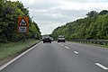
 High Dike (B6403) near Great Ponton - geograph.org.uk - 4214535.jpg 640 × 480; 365 KB
-
 High Dike (B6403) Stoke Rochford - geograph.org.uk - 4214529.jpg 640 × 480; 264 KB
-
 High Dike, B6403 - geograph.org.uk - 4214528.jpg 640 × 480; 247 KB
-
 House near Home Farm, Stoke Rochford Park - geograph.org.uk - 3795290.jpg 1,024 × 768; 203 KB
-
 Lake next to Pasture Farm - geograph.org.uk - 5517898.jpg 3,776 × 2,520; 3.66 MB
-
-
 Layby on the Great North Road - geograph.org.uk - 4222435.jpg 640 × 480; 256 KB
-
 Line of trees with beehives - geograph.org.uk - 6302870.jpg 1,024 × 768; 247 KB
-
 Lodge, Stoke Rochford Park (geograph 5517908).jpg 3,776 × 2,520; 3.81 MB
-
 Mind the bend - geograph.org.uk - 1293693.jpg 640 × 427; 88 KB
-
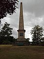 Monument to Sir Isaac Newton - geograph.org.uk - 5910173.jpg 480 × 640; 70 KB
-
 Northbound A1, Stoke Rochford - geograph.org.uk - 4222430.jpg 640 × 480; 260 KB
-
 Obelisk in honour of Sir Isaac Newton - geograph.org.uk - 5517933.jpg 3,776 × 2,520; 4.12 MB
-
 Oilseed rape crop off Ermine Street - geograph.org.uk - 3076826.jpg 640 × 480; 51 KB
-

-
 Overgrown Footpath near Herring's Lodge Farm - geograph.org.uk - 3082259.jpg 2,256 × 1,504; 2.39 MB
-
-
 Ploughed field off Canner's Lane with Triangulation Pillar - geograph.org.uk - 3890820.jpg 4,000 × 3,000; 3.59 MB
-
 Pond to the west of Grantham Road - geograph.org.uk - 3795231.jpg 1,024 × 768; 154 KB
-
 Prepared field near Stoke Rochford - geograph.org.uk - 6303580.jpg 1,024 × 768; 240 KB
-
 Public footpath west of Grantham Road - geograph.org.uk - 3795013.jpg 1,024 × 768; 123 KB
-
 Road to Cringle Farm ^ Cottages - geograph.org.uk - 3079078.jpg 2,256 × 1,504; 1.91 MB
-
 Road to Home Farm - geograph.org.uk - 5237985.jpg 3,582 × 2,262; 3.99 MB
-
 Road to Pasture Farm - geograph.org.uk - 5237973.jpg 3,696 × 2,448; 2.26 MB
-
 Roadway from Heslin's Barn Farm - geograph.org.uk - 6303559.jpg 1,024 × 768; 216 KB
-
 Sheep pasture, east of Grantham Road - geograph.org.uk - 3795049.jpg 1,024 × 768; 180 KB
-
 Sheep pasture, north of Red Cottages - geograph.org.uk - 3795243.jpg 1,024 × 768; 136 KB
-
 Square Plantation - geograph.org.uk - 5096553.jpg 4,000 × 2,992; 5.74 MB
-
 Stoke Park Wood - geograph.org.uk - 4566659.jpg 4,320 × 3,240; 5.25 MB
-
 Stoke Rochford - geograph.org.uk - 164850.jpg 640 × 427; 113 KB
-
 Stoke Rochford approach - geograph.org.uk - 4434248.jpg 640 × 510; 116 KB
-
 Stoke Rochford Hall - geograph.org.uk - 3897037.jpg 4,000 × 3,000; 4.4 MB
-
 Stoke Rochford Hall - geograph.org.uk - 5874804.jpg 640 × 480; 49 KB
-
 Stoke Rochford Park - geograph.org.uk - 3897036.jpg 4,000 × 3,000; 4.33 MB
-
 Stoke Rochford Park - geograph.org.uk - 3897089.jpg 4,000 × 3,000; 4.09 MB
-
 Stoke Rochford Park - geograph.org.uk - 3897093.jpg 4,000 × 3,000; 4.31 MB
-
 Stoke Rochford view - geograph.org.uk - 164852.jpg 640 × 427; 81 KB
-
 Stoke Rochford village pump.JPG 3,456 × 4,608; 3.44 MB
-
 Stoke Rochford, Lincolnshire - geograph.org.uk - 69371.jpg 640 × 480; 178 KB
-
 Stoke Rochford, the post office - geograph.org.uk - 5271351.jpg 640 × 480; 68 KB
-
 Stoke Rochford, the telephone box - geograph.org.uk - 5271356.jpg 640 × 481; 61 KB
-
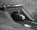 Stoke Tunnel - North end - geograph.org.uk - 3999653.jpg 1,454 × 1,201; 531 KB
-
 Stubble field near Easton - geograph.org.uk - 6302724.jpg 1,024 × 768; 261 KB
-
 The countryside from Grange Farm - geograph.org.uk - 1293706.jpg 640 × 427; 71 KB
-
 The East Coast Main Line at High Dyke - geograph.org.uk - 6322154.jpg 1,024 × 768; 177 KB
-
 The end of Canner's Lane - geograph.org.uk - 6302721.jpg 1,024 × 768; 256 KB
-
 The Meeting Venue by the A1 - geograph.org.uk - 2621956.jpg 640 × 430; 50 KB
-
 The northern corner of Farm Plantation - geograph.org.uk - 3796175.jpg 768 × 1,024; 118 KB
-
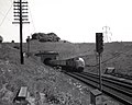
 The old High Dyke railway line - geograph.org.uk - 1290285.jpg 640 × 427; 79 KB
-
 The Old School and School House, Stoke Rochford (geograph 6635061).jpg 1,024 × 768; 162 KB
-
 The track past Cocked Hat Plantation - geograph.org.uk - 5517902.jpg 3,776 × 2,520; 3.38 MB
-
 The Village Hall, Stoke Rochford - geograph.org.uk - 5518363.jpg 3,776 × 2,520; 3.62 MB
-
 Towards Broadlands Plantation - geograph.org.uk - 2627741.jpg 640 × 415; 78 KB
-
 Towards Skillington - geograph.org.uk - 4434249.jpg 640 × 470; 69 KB
-
 Track to Pasture Farm - geograph.org.uk - 6302571.jpg 1,024 × 768; 245 KB
-
 Track to Pasture Farm - geograph.org.uk - 6303575.jpg 1,024 × 768; 272 KB
-
 Track towards Cocked Hat Plantation - geograph.org.uk - 3081016.jpg 2,256 × 1,504; 3.12 MB
-
 Trees along Village Street - geograph.org.uk - 3794992.jpg 1,024 × 768; 160 KB
-
 Trees on a dismantled railway near Easton Lodge - geograph.org.uk - 4566457.jpg 4,320 × 3,240; 5.87 MB
-
 Trees on the north bank of the fish pond - geograph.org.uk - 3795280.jpg 1,024 × 768; 157 KB
-
 Triangulation Pillar TP6204 above Stoke tunnel - geograph.org.uk - 2878906.jpg 1,280 × 853; 611 KB
-
 Valley of the River Witham off Washdike Lane - geograph.org.uk - 3769535.jpg 3,776 × 2,520; 4.05 MB
-
-

-
 Village Street - geograph.org.uk - 598823.jpg 640 × 427; 114 KB
-
 Village Street leaves Stoke Rochford - geograph.org.uk - 4434251.jpg 640 × 462; 79 KB
-

-
 Village Street, Stoke Rochford - geograph.org.uk - 5237994.jpg 3,696 × 2,448; 2.28 MB
-
 Washdike Lane - geograph.org.uk - 4019739.jpg 3,088 × 2,056; 3.97 MB
-
 Washdike Lane Ford across the River Witham - geograph.org.uk - 3769528.jpg 3,776 × 2,520; 4.08 MB
-
 Washdike Lane Ford at Stoke Rochford - geograph.org.uk - 1827312.jpg 3,872 × 2,592; 2.41 MB
-
 Western edge, Farm Plantation - geograph.org.uk - 3795297.jpg 1,024 × 768; 200 KB
-
 Canner's Lane - geograph.org.uk - 282083.jpg 640 × 480; 109 KB
-
 Canner's Lane, further on - geograph.org.uk - 282087.jpg 640 × 480; 93 KB
-
 Fishing Lake, Stoke Rochford Estate - geograph.org.uk - 69367.jpg 640 × 480; 183 KB
-
 Fishing Lake, Stoke Rochford Estate - geograph.org.uk - 69369.jpg 640 × 480; 181 KB
-
 Line of old railway, near Stoke Rochford - geograph.org.uk - 79425.jpg 640 × 427; 106 KB
-
 Near Stoke Rochford - geograph.org.uk - 620293.jpg 640 × 480; 150 KB
-
 New hedge - geograph.org.uk - 282080.jpg 640 × 480; 68 KB
-
 Old Railway track near Stoke Rochford - geograph.org.uk - 69374.jpg 640 × 480; 138 KB


_-_geograph.org.uk_-_3076829.jpg)
_-_geograph.org.uk_-_4017792.jpg)
_-_geograph.org.uk_-_4025435.jpg)


.jpg)

.jpg)


_towards_Colsterworth_-_geograph.org.uk_-_3076824.jpg)


_-_geograph.org.uk_-_3795261.jpg)
_-_geograph.org.uk_-_3795265.jpg)
_-_geograph.org.uk_-_3795270.jpg)


_near_Great_Ponton_-_geograph.org.uk_-_4214535.jpg)
_Stoke_Rochford_-_geograph.org.uk_-_4214529.jpg)


.jpg)


.jpg)


